Bangkok Metropolitan Administration’s Flood Risk Management Platform
Explore the platform:
https://floodmanagement.bangkok.go.th/superset/dashboard/bma-flood-riskIn partnership with:
Context:
Bangkok faces significant threats from climate change, with increased flood vulnerability due to its unique hydro-ecological landscapes shaped by rainfall, rivers, canals, and the sea. Bangkok’s low elevation, rapid urbanisation, and extensive canal network make it highly susceptible to flooding. Shifts in rainfall patterns and intense rainfall events often overwhelm the existing drainage systems, disrupting water supply, housing, public health, and essential public services. A significant obstacle in leveraging data for effective climate action is the fragmented and siloed nature of data, making it difficult for decision-makers to utilise and analyse the climate action impacts. This also affects the required capacity and efficiency - especially during allocating resources and decision-making to build long-term resilience. This often leads to inefficient processes and policies, along with ad-hoc responses that are not data-driven or informed by local realities and needs.
Our solution:
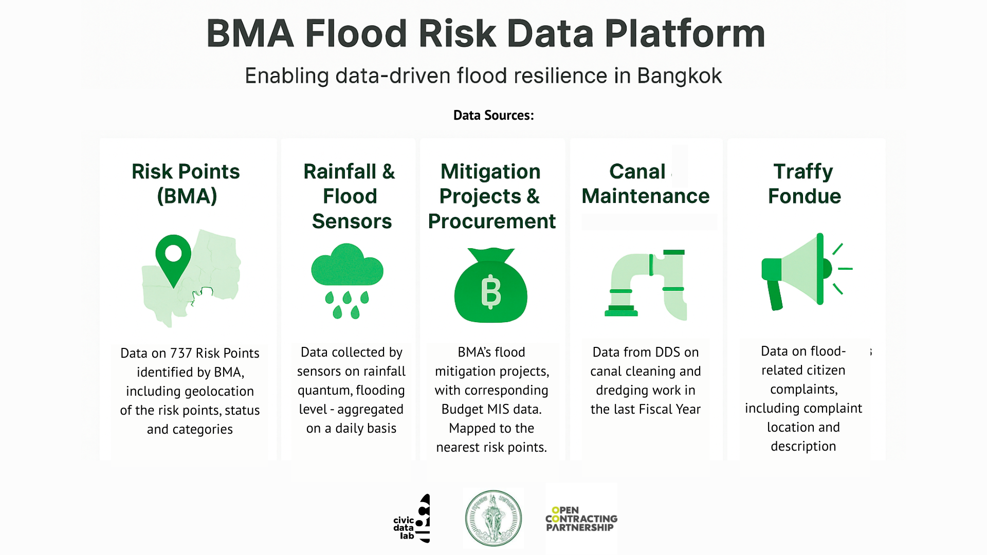
Recognising the critical threat of flooding exacerbated by climate change, CivicDataLab in collaboration with Open Contracting Partnership, and Bangkok Metropolitan Administration (BMA) has developed a Flood Risk Management Platform to strengthen mitigation planning and oversight. This collaborative data visualisation platform is designed to empower BMA officials and policymakers in effectively managing and overseeing flood risk, as well as communicating the same to citizens on an almost real-time basis. Developed using Apache Superset - an existing open-source data analytics tool - the platform integrates data from various sources such as flood related citizen complaints from Traffy Fondue, flooding, rainfall, drainage, and canal data from the Department of Drainage and Sewerage (DDS), flood related budget and procurement data from the Budget Bureau, into one cohesive and user-friendly interface. The platform provides a holistic view of the ground situation, aimed at improving BMA’s flood mitigation efforts through better internal coordination and supervision, reduced data-sharing burdens, enhanced evidence-based decision-making, and greater public engagement.
Explore the platform:
https://floodmanagement.bangkok.go.th/superset/dashboard/bma-flood-riskIn partnership with: